3D Capture Pipelines for Inspection & Documentation
End-to-end capture pipelines that turn a phone scan into a measured, georeferenced, shareable record of a site or asset's condition.
Laan Labs builds complete capture pipelines for organizations that need a reliable record of what something looked like and what condition it was in: insurers documenting property for policies and claims, utilities and infrastructure owners surveying sites and assets in the field, operators inspecting aircraft parts, and owners tracking buildings and equipment over time. A pipeline takes a capture made on an ordinary phone or tablet by someone who is not a 3D specialist, processes it automatically, and produces a measured, annotated record that an adjuster, inspector or engineer can open in a browser, with every finding tied to the place it was seen.
Condition documentation today is mostly photographs in a folder and notes in a form. Photos lack scale and context, notes are subjective, and neither can answer a question nobody thought to ask on site. A 3D capture changes that: the whole space or asset is recorded once, measurements can be taken afterwards, and a reviewer who was never there can look at the same evidence as the person who was. For an insurer, that means better estimates before a policy is written and faster, less contested claims afterwards. For an inspector, it means fewer site visits and a record that holds up later.
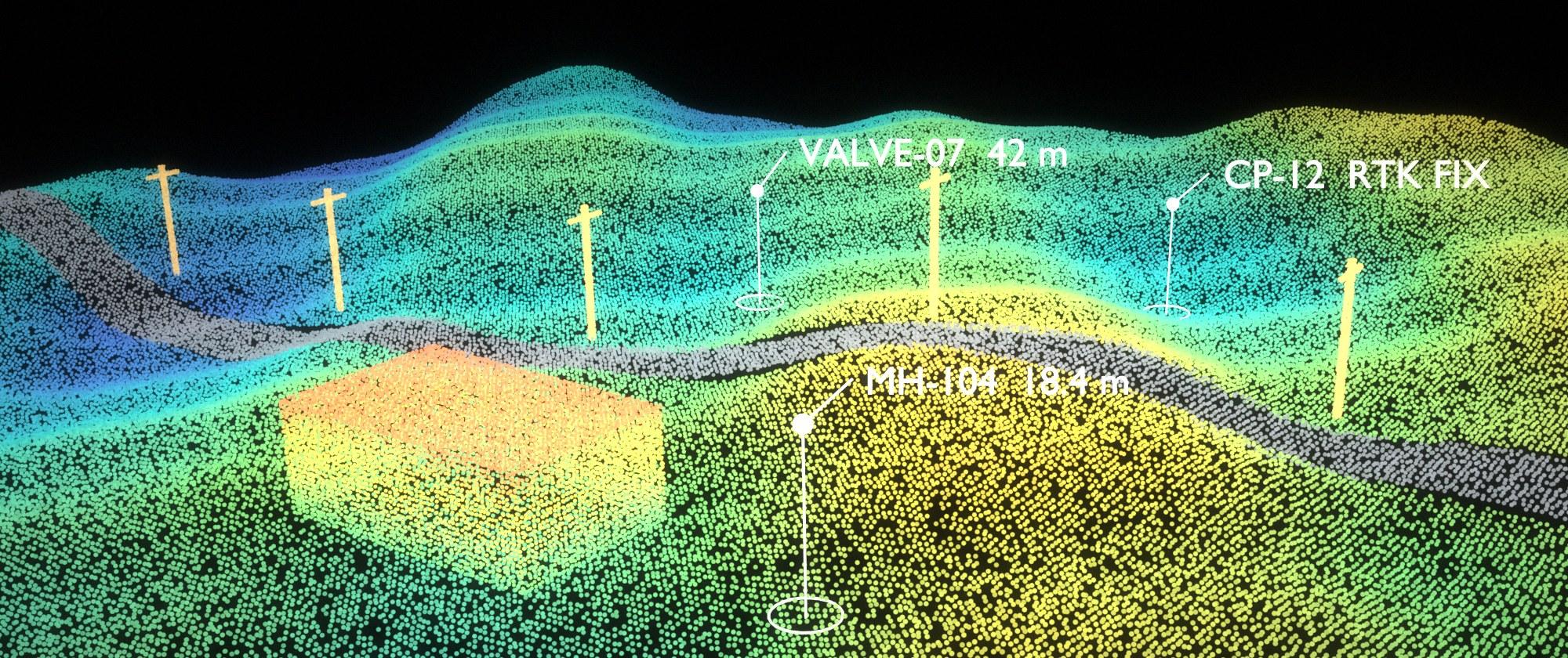
For sites and field assets, where something is matters as much as what it looks like. Laan Labs pipelines tie each scan to a surveyed position from a GNSS receiver, so a LiDAR mesh, point cloud or photo scan lands in real-world coordinates instead of floating in its own local frame. The same workflow runs at every accuracy tier: the phone's own location at 3 to 5 meters for reconnaissance and inventories, an external sub-meter receiver for GIS and utility mapping, or an RTK rover with NTRIP corrections at 1 to 3 centimeters for control and stakeout. Because the capture carries coordinates, it drops straight into GIS and CAD alongside the rest of the project, and it can be found again: augmented reality turns stored coordinates into pins in the camera view, with live direction and distance, so a crew can walk back to a valve, manhole, marker or inspection point months later. Laan Labs has hands-on experience with the hardware as well as the software, having integrated GNSS receivers and survey equipment from Emlid, Leica, Trimble and Bad Elf, among others. Its open-source OpenSurvey3D app shows this scan, anchor and find workflow end to end.
Laan Labs has built these pipelines in production. It delivered a custom scanning solution used by an insurance company for policy estimation and claims, and built RadianceView, which combines mobile scans, LiDAR, Gaussian splats and high-resolution photographs into one inspection record and has been used to document end-of-life airliners for parts reuse. The same components are assembled and adapted for each client's assets, staff and systems.
What we do
- Guided capture for field staff
- iPhone and iPad apps that walk an adjuster, inspector or technician through a capture, check coverage and quality before they leave the site, work without a network connection, and attach the job, policy or asset reference at the source.
- Automated processing
- Uploads are reconstructed without manual steps into the right representation for the job: LiDAR meshes and floor plans for rooms and buildings, photogrammetry for measurable detail, and Gaussian splats for a photorealistic view of the whole scene, aligned at true scale.
- GNSS and RTK georeferencing
- Every capture locked to a surveyed observation before the camera starts, using the device's location, a Bluetooth GNSS receiver or an RTK rover with NTRIP corrections. Fix state, estimated accuracy, satellites, correction age and antenna offsets are recorded with each observation, so a centimeter-grade fix is never confused with a meter-grade one.
- Survey hardware integration
- Direct integration with the receivers and instruments field teams already own, including equipment from Emlid, Leica, Trimble and Bad Elf: Bluetooth and Wi-Fi connections, NMEA streams, NTRIP corrections, antenna height and offset handling, and the practical differences between vendors that only show up on site.
- GIS and CAD integration
- Points, lines, areas and scans collected with the client's own feature codes, attributes and layers, and exported as GeoJSON, CSV, DXF and LandXML in the project's coordinate frame, or imported from existing GIS and design data in CSV, GeoJSON, GPX and KML, so field work and the office system of record stay in step.
- AR asset finding and revisits
- Stored coordinates shown as pins in the camera view, with bearing and distance to a chosen target, to guide staff back to a surveyed asset or inspection point for a repeat capture. AR placement inherits GNSS and compass uncertainty, so it is used to reach an asset, with numeric stakeout and check shots where a position has to be set or accepted.
- Measurement and extraction
- Dimensions, areas and volumes taken directly on the capture; floor plans and room geometry extracted automatically; damaged or changed regions marked up with their size and location for estimating.
- Scan to CAD with AI
- Raw scans converted into structured, editable geometry rather than left as a mesh: walls, openings and rooms as floor plans and DXF, and parts and equipment as exact solid models on a CAD kernel. Vision and language models interpret what is in the scan, recognize components and standard features, and propose the CAD operations that rebuild them, with an engineer reviewing and correcting the result instead of redrawing from scratch.
- AI-assisted findings
- Computer vision and language models that pre-screen captures for damage, defects and missing items, draft the description of each finding, and flag what a human reviewer should look at first, with the reviewer making the call.
- Condition records over time
- Repeat captures of the same property, part or structure aligned to each other so change is visible: before and after a loss, at intake and at return, or across scheduled inspections.
- Review, reporting and sharing
- A browser-based record that an adjuster, engineer, contractor or customer opens with nothing to install, where they can look around, measure, read the findings and export a report. Access is controlled per case. Field work can carry a QA report of check shots against known coordinates, so reviewers see observed accuracy rather than a receiver's own estimate.
- Integration with existing systems
- Captures, measurements and findings delivered into the claims, policy, asset management or maintenance systems an organization already runs, in standard formats, with single sign-on and audit trails where required.
How we work
Projects begin with one real workflow, such as a property claim, a pre-policy survey or a parts inspection, followed end to end with the people who do it. Laan Labs then builds a pilot pipeline for that workflow in weeks and runs it on live cases alongside the existing process, so its effect on time, cost and accuracy is measured before a wider rollout.
Pipelines can be delivered as a solution built on RadianceView, as a white-label app and portal under the client's brand, or as licensed components integrated into existing software. Sensitive captures can be processed on the client's own infrastructure. See 3D capture technology licensing for the licensing options.
A custom pipeline or an off-the-shelf platform?
There are good subscription platforms for capture and documentation, and for many teams one of them is the right answer. Laan Labs is the alternative when the workflow, the data or the integration matters too much to bend around someone else's product.
Workflow
Off-the-shelf platform
You adapt your process to the product's steps and terminology.
Custom pipeline from Laan Labs
Built around how your adjusters, inspectors or crews already work.
Integration
Off-the-shelf platform
The connectors the vendor offers, on the vendor's roadmap.
Custom pipeline from Laan Labs
Wired directly into your claims, asset, GIS or maintenance systems.
Data and privacy
Off-the-shelf platform
Captures are uploaded to and stored in the vendor's cloud.
Custom pipeline from Laan Labs
Processed and stored where you decide, including on your own infrastructure or on the device.
Cost as you grow
Off-the-shelf platform
Per-seat or per-capture fees that rise with usage.
Custom pipeline from Laan Labs
A build cost and a license, without per-seat pricing.
Brand
Off-the-shelf platform
Your staff and customers use the vendor's app.
Custom pipeline from Laan Labs
Your name on the app and the portal.
Capability
Off-the-shelf platform
The capture methods and outputs the product supports.
Custom pipeline from Laan Labs
LiDAR, photogrammetry, Gaussian splats, GNSS and AI findings combined as the job requires.
Time to start
Off-the-shelf platform
Available today.
Custom pipeline from Laan Labs
A pilot in weeks, assembled from components Laan Labs already has.
| Aspect | Off-the-shelf platform | Custom pipeline from Laan Labs |
|---|---|---|
| Workflow | You adapt your process to the product's steps and terminology. | Built around how your adjusters, inspectors or crews already work. |
| Integration | The connectors the vendor offers, on the vendor's roadmap. | Wired directly into your claims, asset, GIS or maintenance systems. |
| Data and privacy | Captures are uploaded to and stored in the vendor's cloud. | Processed and stored where you decide, including on your own infrastructure or on the device. |
| Cost as you grow | Per-seat or per-capture fees that rise with usage. | A build cost and a license, without per-seat pricing. |
| Brand | Your staff and customers use the vendor's app. | Your name on the app and the portal. |
| Capability | The capture methods and outputs the product supports. | LiDAR, photogrammetry, Gaussian splats, GNSS and AI findings combined as the job requires. |
| Time to start | Available today. | A pilot in weeks, assembled from components Laan Labs already has. |
A fair rule: if an existing platform covers nine-tenths of what you need, use it. If capture is central to how you operate or compete, or the remaining tenth is where the value is, a pipeline of your own usually pays for itself.
Related work
3D Scanner Integration
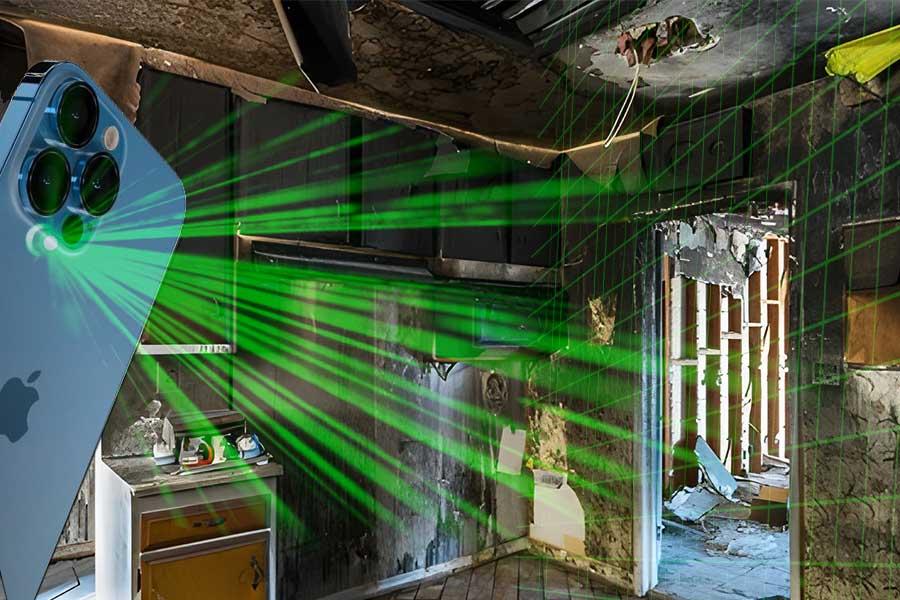
How Licensing 3D Scanner App Revolutionized An Insurance Company's Workflow
RadianceView Aircraft Documentation
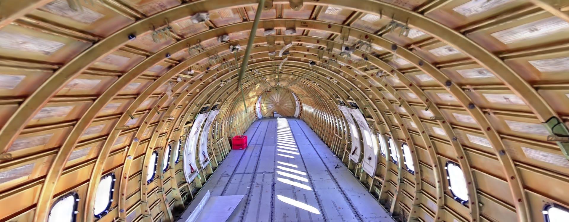
Before a retired airliner is taken apart, its parts need a record. This is how RadianceView and an iPhone turn an aircraft into one: the whole airframe as a splat, the detail as photographs, every finding tied to where it was seen.
Asset Documentation
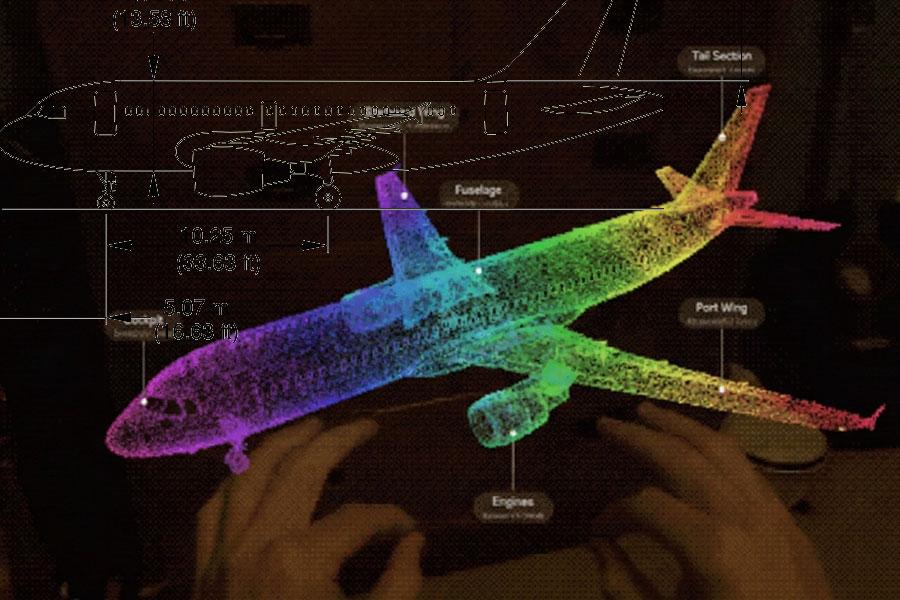
How Laan Labs is transforming the way industries document, inspect, and collaborate on critical assets using spatial computing and AI for Rapid Inspection & Documentation (RID).
Industrial Measurement
Reducing the hassle of managing spaces using Computer Vision

InfraTech 3D Scanning
Workflow overview of how mobile phones are used to capture and create various 3D representations such as NeRF's and Gaussian Splats for managing InfraTech Assets.
Mobile LiDAR Workflows
How professionals are incorporating mobile LiDAR Scanning into their operations
Real Estate & 3D Scanning
How Mobile 3D LiDAR is changing how the industry works.
3D Room Scanning
Scanning Spaces, with a focus on geometry and inventory.
Products built with this work
- RadianceView — Inspection-grade visual records in a browser
- OpenSurvey3D — Open-source 3D scanning, GNSS surveying and AR asset finding for iPhone and iPad
- OpenPlan3D — Open-source floor plans from iPhone LiDAR scans, with DXF export
- OpenShape3D — Open-source solid-modeling CAD on the OpenCASCADE kernel
Common questions
How is 3D capture used in insurance?
Insurers use 3D capture at two points. Before a policy is written, a scan of the property records its size, layout, contents and condition, which improves the estimate and establishes a baseline. After a loss, a scan of the damage lets an adjuster measure and assess it remotely, shortens the claim, and gives both sides the same evidence. Laan Labs built a custom scanning solution for an insurance company covering both policy estimation and claims.
Who does the capturing, and what equipment do they need?
Usually the people already on site: adjusters, inspectors, technicians, contractors, or in some workflows the customer. A recent iPhone or iPad is enough for most rooms, buildings, vehicles and parts, and the app guides them through it. Laan Labs adds drones, 360° cameras or survey-grade scanners to a pipeline only where the asset requires them.
How do GNSS and RTK make a scan more useful?
A scan on its own is accurate internally but has no place in the world. Tying it to a GNSS position gives it real coordinates, so it lines up with maps, design drawings, other scans of the same site and earlier visits. Laan Labs pipelines work with the phone's location (3 to 5 meters), external sub-meter receivers (0.3 to 1 meter) and RTK rovers with NTRIP corrections (1 to 3 centimeters), and record the quality of every fix so each capture is used only for what its accuracy supports.
Which GNSS receivers and survey hardware does Laan Labs work with?
Laan Labs has integrated GNSS receivers and survey equipment from Emlid, Leica, Trimble and Bad Elf, among others, alongside the positioning built into iPhone and iPad. Pipelines are built to be receiver-agnostic: they connect over Bluetooth or Wi-Fi, read standard NMEA output, apply NTRIP corrections for RTK, and record the receiver, antenna offsets and fix quality with every observation, so a client can use the hardware it already owns or choose what suits the accuracy the work requires.
How does augmented reality help with asset inspection?
Once assets have surveyed coordinates, AR can lead someone back to them. Raising the phone shows nearby assets as pins over the camera view with direction and distance to the chosen one, which turns "somewhere near this dot on the map" into a path on the ground. That makes repeat inspections of buried utilities, control points, markers and equipment faster and less dependent on the person who was there last time. Laan Labs' OpenSurvey3D app does this for any asset within 250 meters.
Can captures be used in our GIS?
Yes. Georeferenced captures and the features collected with them export as GeoJSON, CSV, DXF and LandXML with the client's feature codes, attributes and CAD layers intact, and existing GIS or design data can be imported to guide field work. Laan Labs also integrates directly with a client's GIS or asset management platform where a file exchange is not enough.
Can a scan be turned into a CAD model automatically?
Increasingly, yes. Room scans already convert to floor plans with walls, doors and windows as editable geometry that exports to DXF. For parts, equipment and structures, Laan Labs combines geometric fitting with vision and language models that identify what a scanned object is, which features it has, and which CAD operations would reproduce it, and outputs an exact solid model built on a CAD kernel rather than a triangle mesh. A person still reviews the result, but checking and adjusting a proposed model is far faster than modeling from a point cloud by hand.
Are measurements from a phone scan accurate enough?
For estimating, documentation and most inspection work, yes. iPhone and iPad LiDAR is accurate to roughly the centimeter at room scale, and close-range scanning of parts is finer. It does not replace survey-grade instruments where millimeter precision is contractual, and a well-designed pipeline states the expected accuracy with each measurement so reviewers know what they can rely on.
Can AI detect damage automatically?
AI is effective at screening: finding likely damage, defects or anomalies, describing them and prioritizing review. Laan Labs builds pipelines where models do that first pass and a qualified person confirms each finding, which is both faster than manual review and appropriate for decisions that carry financial or safety consequences.
Can the pipeline connect to our claims or asset management system?
Yes. Laan Labs integrates capture pipelines with existing claims, policy administration, asset management and maintenance systems, so a capture is requested from, and its results returned to, the system staff already use. Exports include standard 3D formats, floor plans and PDF reports.
How is sensitive capture data handled?
Captures of homes, facilities and aircraft are sensitive, so pipelines are built with access control per case, encryption in transit and at rest, and audit trails. Processing can run on the client's own infrastructure rather than a shared cloud when policy or regulation requires it.
Start a conversation
Tell us about the project and one of the founders will reply. Email labs@laan.com or use the contact form.
Related services: 3D Capture & Licensing, Gaussian Splatting, Computer Vision & AI
Industries: Insurance & Claims, Real Estate, Robotics & Automation, Utilities & Infrastructure, Aerospace & MRO, Construction & AEC