Utilities & Infrastructure
Georeferenced 3D capture, GNSS field collection and AR asset finding for utility owners, contractors, municipalities and surveyors.
Laan Labs builds field software for utility owners and operators, contractors, municipalities and surveyors who need to know exactly what is in the ground and on the site, and to find it again. Crews capture assets as 3D scans tied to surveyed GNSS positions, collect points, lines and areas with their own feature codes, and later walk back to any asset with augmented reality showing direction and distance. The approach is embodied in OpenSurvey3D, Laan Labs' open-source app for 3D scanning, GNSS surveying and AR asset finding.
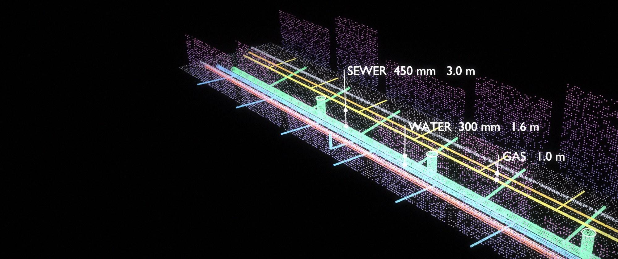
Records of buried and built infrastructure drift from reality. As-builts are drawn from memory after the trench is closed, assets are mapped to the nearest few meters, and the knowledge of where things really are leaves with the people who installed them. The window to fix that is short: while a trench is open or a structure is exposed, a phone scan locked to an RTK position records the pipe, the fittings, the depth and the surroundings in minutes, in real coordinates, for good.
Laan Labs has hands-on experience with the equipment as well as the software, having integrated GNSS receivers and survey hardware from Emlid, Leica, Trimble and Bad Elf, among others, and builds the workflow to be honest about accuracy: a centimeter-grade RTK fix is never presented the same way as a phone position.
How Laan Labs helps
- Open-trench and as-built capture
- LiDAR and photo scans of exposed pipes, ducts, fittings and structures, anchored to a surveyed observation before backfill, giving a measurable as-built that shows what was installed and exactly where.
- Asset inventory and field collection
- Points, lines and areas for poles, valves, manholes, hydrants, cabinets and corridors, collected with the organization's own feature codes, attributes and photographs, at the accuracy the job requires.
- RTK georeferencing
- Support for the phone's location, external sub-meter receivers and RTK rovers with NTRIP corrections, with fix state, estimated accuracy, satellites and antenna offsets stored with every observation.
- AR asset finding
- Stored coordinates shown as pins over the camera view with bearing and distance, so a crew can walk back to a buried valve or a control point without hunting. It is a finding aid: it does not replace utility locates or numeric stakeout where a position must be confirmed.
- GIS as the system of record
- Import of existing asset and design data in CSV, GeoJSON, GPX and KML, and export as GeoJSON, CSV, DXF and LandXML in the project coordinate frame, with direct integration to a GIS or asset management platform where required.
- Inspection of structures and corridors
- Repeatable captures of tunnels, culverts, bridges, roads and facilities, with findings tied to location and compared between visits to show change.
- Field quality assurance
- Check shots against known coordinates, residuals and tolerances, and a QA report that travels with the data, so the office can accept field work on evidence.
Where to start
A practical first project is one crew and one activity, such as documenting service installations before backfill or inventorying a class of asset in one district. Laan Labs configures or builds the capture workflow around the existing codes, coordinate system and receivers, and the results are checked against control before the approach is extended.
Organizations that want to evaluate the workflow at no cost can start with OpenSurvey3D, which is free and MIT licensed, and engage Laan Labs to adapt it, integrate it with their GIS, or build a dedicated application on the same foundation.
Related work

InfraTech 3D Scanning
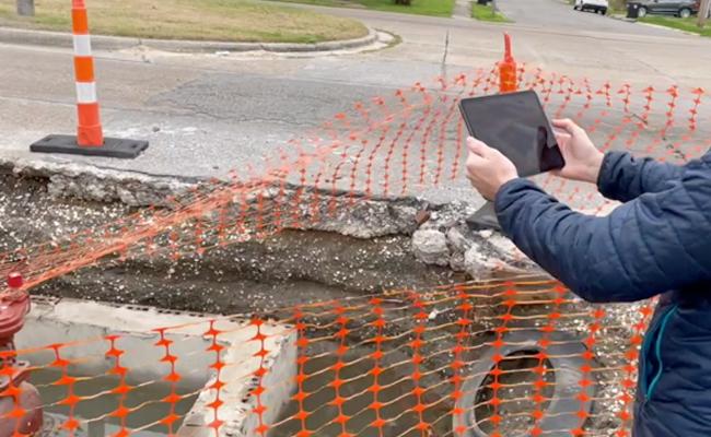
Workflow overview of how mobile phones are used to capture and create various 3D representations such as NeRF's and Gaussian Splats for managing InfraTech Assets.
Mobile LiDAR Workflows
How professionals are incorporating mobile LiDAR Scanning into their operations
Industrial Measurement
Reducing the hassle of managing spaces using Computer Vision
Real Estate & 3D Scanning
How Mobile 3D LiDAR is changing how the industry works.
Laan Labs products in this field
- OpenSurvey3D — Open-source 3D scanning, GNSS surveying and AR asset finding
- RadianceView — Scans, splats and photographs as one inspection record
Common questions
What accuracy can field capture achieve?
It depends on the position source. A phone's own location is good to about 3 to 5 meters, suitable for reconnaissance and inventories. An external sub-meter GNSS receiver gives 0.3 to 1 meter for GIS and utility mapping. An RTK rover with corrections gives 1 to 3 centimeters for control, topographic work and stakeout. The scan geometry itself is accurate to roughly the centimeter at room scale.
Which GNSS receivers are supported?
Laan Labs builds receiver-agnostic workflows and has integrated equipment from Emlid, Leica, Trimble and Bad Elf, among others. Receivers connect over Bluetooth or Wi-Fi, standard NMEA output is read directly, and NTRIP corrections are applied for RTK.
Does it work without mobile coverage?
Yes. Capture, collection and AR finding run on the device, with maps and the working area downloaded in advance and data synchronized when a connection returns. RTK corrections over NTRIP need a data connection; without one, positions are recorded at the receiver's standalone accuracy and marked as such.
Can AR replace utility locating?
No. AR shows where records say an asset is, with the uncertainty of the underlying GNSS and compass, and is used to reach the vicinity of an asset quickly. It does not replace utility locates, safe digging procedures or survey stakeout where a position has to be confirmed.
Start a conversation
Tell us about the project and one of the founders will reply. Email labs@laan.com or use the contact form.
Services for this industry: Capture Pipelines & Inspection, Gaussian Splatting, Spatial Computing, AR & VR
Other industries: Insurance & Claims, Real Estate, Medical & Body Scanning, Robotics & Automation, Aerospace & MRO, Construction & AEC